Showing posts with label Archaeology. Show all posts

27 November 2024

The Four Corner’s potato

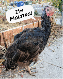
Alastair Lee Bitsóí, Diné, holds a harvest of Four Corners Potatoes in a Diné Basket at his farm in the Navajo Nation. Photo Credit: Alastair Bitsóí

Local Indigenous foods: the Four Corner’s potato (Solanum jamesii).

Most of the world’s potatoes are descendants of a single South American native potato species, Solanum tuberosum, but Utah’s native potato is a different species.

Within the last 100-150 years, the Four Corner’s potato has largely been forgotten with few people (Indigenous and Non-Indigenous) recalling its abundance and importance.

That has changed within the last few years; the Four Corner’s potato is being revived as a native food.

Researchers from the University of Utah, primarily headed by Lisbeth Louderback, identified potato starch residue preserved on 10,000-year-old artifacts in the Escalante region of Utah.

That discovery prompted researchers to look for, and find, patches of wild Four Corner’s potato growing near the archaeolgocial site.

The Four Corners potato plant grows well in the high desert of New Mexico and it grows much more sparsely in Utah, often near archaeological sites; this, along with reduced genetic diversity measured within the Utah potato population, suggest that potatoes were brought to the Escalante region by ancient people- likely from what is now New Mexico.

In modern times, Indigenous farmers and researchers have been sharing their experiences with growing, harvesting, and preparing the native potato.

Cynthia Wilson and Alastair Lee Bitsóí, both Diné, have publicly discussed their revival work of the Four Corner’s potato.

Alastair is relearning how to grow the plant on his farm and he continues the practice of redistribution.

Cynthia has talked about her ancestors’ methods to prepare the food, including boiling the potato with bentonite clay- a traditional Diné method to reduce bitterness.

Researchers have called the Four Corner’s potato the “fourth sister” or “lost sister” as an indication of its importance as a native food. This is of course a reference to the three sisters- corn, beans, and squash.

Collaboration on the Four Corner’s potato continues.

External Links and Sources:

06 November 2024

Urban Calm by Peter Wiarda

Framed print of a photograph from Peter Wiarda’s new book “Urban Calm.”

This is my favorite photograph from Peter Wiarda’s new book “Urban Calm.” This is photo is the view from Walker Center Parking at 160 S. Regent St. (2020). It looks south on Main Street, towards 300 South.

In this image I see an abstract view of modern archaeology of Salt Lake City’s built environment (and the real archaeology that is also subsurface).

The oldest building in this image is the Karrick Block, built in 1887. Surprisingly, the oldest building is also the most colorful (red) building in the photograph, which reminds me that the historic black and white photographs that preserve the past do not portray a fully perfect image of the past.

The Karrick Block has an interesting preservation story, which I will need to post about separately.

Also in this photograph are:
  • The Lollin Block, 1894
  • Clift Building, 1919
  • American Towers, 1982
  • One Utah Center, 1991
  • 222 S Main building, 2009
  • Federal Courthouse (Orrin G. Hatch/the Borg Cube), 2014

Peter Wiarda's print with my identification of buildings

Notably, there is 5-decade gap of buildings in this image. Part of that is simply that buildings of this age are not in view. But the other part is that downtown SLC had a lull in construction during the Great Depression, WWII, and the post-WWII suburban build-up. There are notable exceptions (e.g. mid-century modern Ken Garff Building 1955, LDS Church Office Building 1973), but in general this image portrays an accurate pattern of downtown SLC’s history.

The American Towers building is also an interesting component, Built in 1982, it represents an effort to draw individuals back to living in downtown. But interestingly, American Towers was initially an adult only living arrangement- so not an effort to bring families with children to downtown.

So, beyond the visual beauty of the photograph I also see a full historical spectrum of SLC.

Peter Wiarda has many other fantastic photos of SLC in his Urban Calm book.

And SLUG magazine has a nice article about Peter’s project. 

Be sure to check out his website where you can order your own copy of the book. www.peterwiarda.com

23 April 2024

Old Utah Tomato Varieties

Utah tomato varieties are my current historic interest!

Image from Stokes Seeds 112 Superb Varieties 1926
 
In prehistoric times, the tomato originated in South America and made its way north to the area that is now Mexico. Thus far, there is no evidence that the tomato made its way to North America until after the arrival of Euro-American settlers. Despite its once-feared reputation by Euro-Americans, by 1850 the tomato had made its way into most urban markets in North America.

The early Mormon pioneers also cultivated tomatoes in the Salt Lake Valley. In 1857, horticulturalist Edward Sayers was selling tomato seeds from varieties that he grew. And in 1859 he announced the creation of an experimental garden to determine what fruits, vegetables, flowers, etc would grow best in the Salt Lake Valley (I’ll need to investigate this further, fascinating!).

However, it is unclear what specific varieties were cultivated in these early days (as far as I can find, to date), beyond just a description of red and orange varieties. Tomatoes were primarily grown for home use.

A 1927 report titled Tomato Culture in Utah by A.L. Wilson, recounts a brief history of the tomato in Utah. The report emphasizes the Utah tomato canning industry, which started in Ogden in 1888 and continued to grow, primarily in northern Utah.

The 1927 report also mentions popular varieties being grown at that time, with notes about each variety:
  1. Stone: best for canning. Dark red in color with firm flesh. Long to mature.
  2. Norton: wilt-resistant. Good for shipping and canning. Not as productive as other varieties.
  3. Greater Baltimore: Most popular variety in Utah for canning. Ripens earlier and larger yields. Not so well colored as the Stone.
  4. Landreth: Increased in popularity, especially among Japanese growers. Larger yields with more frequent pickings. Inferior in color and firmness.
  5. Other varieties: Ignotum, Red Head, Red Rock. New “potato-leaf” varieties are noted. A hybrid named “Utah Valley”

Image from Stokes Seeds 112 Superb Varieties 1926

Image from The Canning Trade 1917

Other varieties were developed after 1927, especially by Utah State University, such as the Hamson DX -52-12 which was developed by Dr. Alvin Hamson (1924-2009) for the Campbell Soup Company.

I've also seen reference to Utah tomato varieties such as Pink Pioneer, Big Hill, and Moscow.

More to come.

10 August 2022

Ancient Footprints Persevered in the Great Salt Lake Desert

Ancient footprints are preserved in the Great Salt Lake Desert.  An excavated footprint is in the foreground but you can also see unexcavated footprints (which appear like darker shadows in this image) in the background. July 2022.

Hill AFB recently announced a unique archaeological site in the GSL Desert on their South Bombing Range.

Named the Trackways Site, it consists of several tracks of human footprints likely dating to about 12,000 years ago.

Thousands of Paleo-age archaeological sites have been found in this area of the GSL Desert, including the famed Wishbone Site with a radiocarbon date on a fire hearth of 12,300 years ago. Although the finding of intact human footprints is surprising, it is in line with previous discoveries in the area.

The archaeologists are being cautiously optimistic about the authenticity of the find, citing more research is required.

I visited this site a short time before the official press release; I went in skeptical and left fairly convinced of its human antiquity. The stratigraphy is what ultimately convinced me.

Nowadays, that area of the GSL Desert is a wide-open alkali flat almost void of all flora and fauna, which means most people avoided it for most of the last 10,000 years.

The GSL Desert was once the bottom of Lake Bonneville in which fine silts were deposited on the lake floor. Then, during the waning years of Lake Bonneville, the area became a vast wetland fed by overflow water through the Old River Bed and springs, thus creating a vast wetland known as the Old River Bed (ORB) Delta.

The type of sediment deposited during each of these stages also changed from the fine silts of a deep lake to the sands and gravels transported by faster flowing streams.

These unexcavated footprints are inverted sand-filled prints. The sand erodes at a slower rate than the surrounding Lake Bonneville silt, These footprints are a part of a longer footprint trackway. July 2022.

The footprints themselves appear to have been formed when people walked in the shallow water of this ancient wetland. Their feet sunk through the sand into the underlayer of fine Bonneville silts, which were then filled in with the overlayer of sand after the foot was removed. Consequently, the footprints were preserved as sand-filled imprints, some of which are now exposed as inverted sand prints surrounded by alkali flats.

Here is the link to the original Hill AFB press release

07 August 2022

More about Lake Bonneville!

Lake Bonneville was a Pleistocene-age lake (the last Ice Age). Similar to how the Great Salt Lake is today, the shorelines of ancient Lake Bonneville responded to changes in climate; the lake level increased when it was wetter/cooler and it lowered when it was warmer/drier.

Lake Bonneville was one of several closed-basin lake systems in the Great Basin during the last Ice Age; Lake Lahontan in Nevada being the largest but lots of little ones too. If you find yourself on a playa anywhere in the Great Basin, then you are at the bottom of an ancient lakebed.

The maps in my post show the geographic extent of Lake Bonneville overlayed on top of a modern map. I will detail the SLC area in my next post. The images are in order of highest elevation to lowest, but not in chronological order.

The Stansbury level is the oldest of the main shorelines. The final image shows the Great Salt Lake modern low (today).

Lake Bonneville was a cold freshwater lake. The highest mountain tops (Wasatch, Deep Creeks, etc) had large glaciers and the lake had its fair share of icebergs floating around, it was the Ice Age after all.

My interest in Lake Bonneville relates to the first people living in our area. It’s unclear exactly when people first inhabited the Bonneville Basin. Clearly, people did not live underwater but the shorelines certainly were utilized at some point.

Archaeological evidence shows that people were living and working along shorelines, at least around the Gilbert phase during the Pleistocene-Holocene transition.

A human-made fire hearth documented at the Wishbone archaeological site in the Great Salt Lake Desert shows people were in this area at least by 12,300 years ago. It seems that at least parts of the lake at this time supported freshwater fish and there is direct evidence of Mammoths and waterfowl present, making it an attractive place for ancient people.

Paul Inkenbrandt has put together a fantastic Story Map of Lake Bonneville that you should check out. https://storymaps.arcgis.com/stories/f5011189bdc94545b9231d56e4ffc1e4


26 March 2022

An introduction

Hey all! I thought I should finally introduce myself. I’ve been off social media for a while tending to seed starts for my garden and giving myself a little mental break.

So, about me:

I’m an archaeologist who works in the West Desert, but I typically don’t spend much time in the field anymore as my duties are more about management and interacting with leadership.

I live near downtown SLC in District 4. I own a small house on a small lot with my family. We don’t have any grass and both our front and back yards are garden. We grow a variety of squashes, tomatoes, and death peppers.

I used to hate history class and thought it was so boring to memorize dates of military battles and the basic facts of only certain types of people.

My first archaeological project was while I was a student at the University of Utah. I helped with the mitigation excavation of Fort Douglas in preparation for the construction of the 2002 Olympic Village, now student housing.

It was through archaeology that I realized we could see into the lives of people who were not in the history books, such as the women who worked along Laundress Row at Fort Douglas in the 1890s.

I tend to focus on everyday people of SLC’s past and try to revive the stories and circumstances that have been forgotten.

I’ve been researching and writing about SLC history for over a decade and I’ve come across some interesting stories that I can write up.

Comment below if you have a specific interest.

24 November 2021

Prehistoric Domestication of Turkeys and Their Complex Relationship with Their Keepers

Aztec illustration from the Florentine Codex featuring a turkey.

Turkeys were domesticated in 2 regions of the Americas more than 2,000 years ago.

The Ancestral Puebloan people of the American Southwest domesticated the Eastern and the Rio Grande subspecies of turkey. This Puebloan breed is now extinct.

The Aztecs and their predecessors in Mexico domesticated the Ocellated subspecies, a colorful turkey that is now endangered. It was the Aztec variety of domesticated turkey that the Spanish encountered and recorded in the Florentine Codex.

The Aztec turkeys were shipped to Spain in the early 1500s where they were then distributed throughout Europe and selectively bred to produce the domesticated varieties we know today. The original Aztec breed is thought to still exist and genetic studies to sort out its lineages are ongoing.

I keep 2 female Spanish Black Turkeys, a heritage breed said to be closely related to what the Spanish found in the Americas.

Adult female Spanish Black turkey, 2021.
Adult female Spanish Black turkey who likes to strut her stuff., 2021.

Adult female Spanish Black turkey, 2021.
The two female turkeys are side by side. They are the
same age and size, when not strutting. 2021.

Turkeys were/are very important to Pueblo people and archaeological evidence indicates they were kept in pens but also allowed to free-range forage. They mostly ate maize as provided by their keepers, their eggs were collected for food, and their feathers were used in a multitude of ways. Many of the turkeys were eaten for food and their bones were used to make items such as awls and flutes but some turkeys were buried in a prepared grave indicating a special relationship.

Southern Utah’s Ancestral Puebloan people made blankets from turkey feathers wrapped around yucca cordage; a rarely preserved example is housed at Edge of the Cedars State Park Museum in Blanding and likely dates to the 1200s.  

Body feathers from turkeys have lots of fluffy down and these were collected from several turkeys to make the blanket. It is likely that the feathers were collected from live birds undergoing their seasonal molt, a time when the feathers can be removed without causing the bird to bleed.

A turkey body feather shed during molting.

This Thanksgiving, think of that relationship between those prehistoric turkeys and their keepers. A relationship that was/is memorialized in turkey genetics, an ancient codex, art, music, religion, and fluffy blankets.

Sources:

14 November 2021

The Fremont Settlement of Block 49

More evidence of a Fremont-age village (and the first informal Mormon Pioneer Cemetery) was found in the 1980s during construction of the Palladio Apts at 360 S 200 West SLC, on the eastern half of Block 49- the block just east of Pioneer Park.

Now known as the Block 49 Site, the site has 2 main components: the lowest is the Fremont occupation while the upper are the historic burials (1847-1850s) and the historic occupation through the 1950s.

The cultural remains of the Fremont found at Block 49 could be an extension of the Fremont Village at South Temple (see previous post). Block 49 is also along an old channel of City Creek and the radiocarbon dates of 830-1240 AD are consistent with South Temple.

Many of the artifacts recovered from Block 49 show a similar lifeway as the Fremont at South Temple: They built homes, made pottery, repaired hunting gear, and traded for Olivella shell beads. They ate maize, beans, and wild foods- especially fish.

The remarkable aspect of Block 49 is the large amount of fishing gear such as bone harpoons, fishhooks, and fishhook blanks. Fish bone remains include Utah chub, Utah sucker, Cutthroat trout indicating fishing in both the colder fast-moving City Creek (trout) and the slower and warmer Jordan River (chub).

In addition, partial skeletal remains of 3 Fremont individuals were found. The most complete was that of a female in her 20s. Her remains were significantly impacted by construction and were retrieved from back dirt.

Block 49 was a salvage excavation focused on removing the pioneer skeletal remains so very little of the Fremont occupation was explored. Much of what was found had been intruded upon by the pioneer burials. It seems likely Fremont human remains have been partly/wholly exhumed throughout the historic period by the digging of graves and the construction of buildings.

Historic records indicate that the Pioneers deliberately chose their first informal cemetery to be located on an “Indian Mound” (remains of the Fremont culture) because the soil was softer and easier to dig. Fremont artifacts were most certainly unearthed when the Pioneers dug more than 30 graves.

Source:
BYU Museum of Peoples and Cultures Technical Series No 03-07. The Right Place- Fremont and Early Pioneer Archaeology in Salt Lake City. By Richard K. Talbot, Shane A Baker, and Lane D. Richens. 2004.  Images 2-6 are taken from this manuscript. 

The Palladio Apts (360 S 200 West) now located on top of Block 49 historic cemetery and a Fremont village. Nov 2021.

Looking west at the Block 49 site prior to archaeological excavation. Arrows point to exposed historic coffins. The prehistoric Fremont component is below the coffins.

Overview of the South Temple and Block 49 Fremont sites showing proximity to City Creek and the Jordan River.

Bone harpoons from Block 49.

Bone needles, fishhooks, awls, and pressure flaker from Block 49.

Selection of ceramic artifacts from Block 49.

Construction of Edison House (335 S 200 West) in the foreground and the Palladio Apts in the background, both on 200 West Street. If the Fremont site extended east from Block 49 then it has been significantly impacted by Edison House’s deep foundation. Nov 2021.

10 November 2021

City Creek Village under South Temple Street

The prehistoric village that existed under downtown SLC (see previous post) was occupied by many family groups of the Fremont Culture over multiple generations, at least between about 800-1,000 years ago.

The village was situated near City Creek, a good source of water for household and agricultural purposes ( the same reason the Mormon Pioneers also liked the area).

A total of 7 house structures and 2 ramada work areas were uncovered in just this small area under South Temple, indicating a much larger village was likely present. The people of City Creek Village relied heavily on farming- remnants of maize and beans were found but they also likely planted squash and melons.

Their reliance on agriculture is also shown in the type of grinding stones they used – deeply shaped metates and two-handed manos that could grind lots of maize. Stable carbon isotope analysis also shows a diet heavily reliant on maize and less reliant on wild foods, especially when compared to other Fremont groups who lived along the Great Salt Lake wetlands near Ogden and Brigham City.

However, the City Creek folks still incorporated wild foods in their diet including Bighorn sheep, deer, bison, pronghorn, elk, sage grouse, jackrabbit, trout, chub, ducks, geese, cattail, ricegrass, and goosefoot.

The village was also involved with trade networks. A shell bead made of Olivella, native to the Pacific coast, was found as well as a ceramic fragment of Tsegi Orange Ware from the Ancestral Puebloan area to the south.

Other artifacts indicate that they were normal people doing everyday things like cooking, cleaning the house, taking out the trash, mending and making clothing, fixing hunting gear, playing music, using medicines to help the sick, and taking care of the elderly.

The remains of the induvial found by the TRAX construction crew was that of a man in his 50s. At his death, he had extensive loss of bone density, advanced spinal arthritis, and cervical vertebrae degeneration (C4-C5 had completely fused; C5-C7 were compressed). He had also lost most of his teeth and had abscesses in his jaw. Very painful. After death, he was carefully buried in a prepared grave, probably lined with grasses.

Source:
BYU Museum of Peoples and Cultures Technical Series No 03-07. The Right Place- Fremont and Early Pioneer Archaeology in Salt Lake City. By Richard K. Talbot, Shane A Baker, and Lane D. Richens. 2004.

Images 1-8 are from the cited BYU monograph. 

Partially reconstructed Snake Valley Black-on-gray ceramic bowl.

Partially reconstructed Great Salt Lake Gray ceramic jar.

A bone whistle.

Selected two-handed manos.
Archaeological excavation of Structure 1.
Archaeological excavation of Structure 5, note melted adobe in middle.
Plan view of Structure 2.


Archaeological plan view excavated area of Area A on South Temple.

Interpretive plaque located at the Arena TRAX station showing excavated area, 2021.

07 November 2021

Prehistoric Village under South Temple

Archaeological excavation along South Temple near 300 West, 1998

A Fremont aged archaeological site was discovered in 1998 during the construction of TRAX light rail along South Temple at 300 West.

A backhoe operator noticed a human skull during construction and notified UTA, who then called the Antiquities Section of State History and they consulted with the Utah Division of Indian Affairs.

Two weeks later another burial was found just to the north of the first. An expedited archaeological excavation was conducted in the area and then construction was allowed to continue.

The South Temple site offered a window into an extensive village built near City Creek and dating between AD 950-1150, a period known as the Fremont Cultural Complex.

These City Creek Fremont built a large village with fields of maize and beans. They also harvested native plants, hunted large and small wild game, and collected fish, frogs, and turtles from the nearby waterways.

The South Temple excavation area only gives a glimpse into the larger Fremont village that once existed where SLC is now. Other discoveries (more details later) suggest a larger settlement area.

Other Fremont aged settlements have been noted by early Euro-American settlers and government surveyors in Davis County, Tooele County, Utah County, Weber County, and elsewhere. Brigham Young seemed to be fascinated by the “Indian mounds” (interpreted today as collapsed house structures and/or burial sites) of Parowan Valley but made no mention of the mounds that must have existed in the Salt Lake Valley nor of the artifacts and human remains that were likely uncovered during plowing activities, canal building, railroad building, and structural construction.

However, as noted in my Hells Hollow post, along with several historic newspaper clippings I have come across, Native American burials (of varied antiquity) were very much known to exist within SLC by the newcomer Euro-Americans. Further, In the 1870s several miners were quoted in government reports acknowledging the existence of “several mounds of great antiquity” in the Salt Lake Valley along the Jordan River.

In the next post we will explore the specifics of the South Temple Fremont archaeological site.

The Arena TRAX station memorialization of the
South Temple Fremont archaeological site, 2021

The South Temple archaeological site today, under TRAX, 2021.

06 November 2021

Native American Heritage Month Preview

November is Native American Heritage Month and there are so many stories to tell about Utah’s indigenous people- how they have been treated in the past and present, how they have served in the military for hundreds of years (including a special unit at Fort Douglas), food heritage, notable leaders, technology, traditional sports and games (including modern tournaments), and so much more.

“Gathering” by Diné (Navajo) artist Jack To'baahe Gene (Raymond Gene Jr.), 1980.
From the National Museum of the American Indian collections.

This year I would like to tell some stories about the people who lived in the Salt Lake Valley well before the Mormon pioneers arrived in 1847. Hopefully, these stories will help illustrate that when Brigham Young arrived it was not an empty valley, and indications of a long and rich indigenous culture were- and are -all around.

Native American Boarding Schools have been in the news lately and Utah certainly was a part of this history. Utah had 6 Native American boarding schools with the Intermountain Indian School in Brigham City (formerly the Bushnell Army Hospital) being one of the largest in the U.S. and was one of the last to close, in 1984.

I will probably not get into any of these stories about the boarding schools but there is a good 2-part documentary produced by @pbsutah called “Unspoken: America's Native American Boarding Schools.”

I also highly recommend @pbsutah’s 5-part series about the 5 Native Tribes of Utah, “We Shall Remain.” This series is great because it mostly talks about the current conditions that our local Tribes face.

My next series of posts will be about the archaeological remains of SLC’s first population. My next post will be about why there is that terrible representation of an “arrowhead” at the Arena TRAX station on South Temple St in downtown SLC.


Direct links to the documentaries are here:

23 October 2021

The Witch's House in City Creek Canyon... Is Really the Empire Mill

SLC urban legends tell of the “Witch’s Cabin” (or house or hut) located in City Creek Natural Area above Memory Grove Park (about where 11th Ave would cross City Creek).

Foundation of the Sudbury House (and later Bandstand),
part of the Empire Mill complex, Oct 2021.
 
The tales vary but usually include disembodied lights and voices. Sometimes it is a bad witch, sometimes a good witch, and sometimes the witch turns into a tree. Often the stories get muddled with other tales of Memory Grove.

The actual history is that this stone foundation is the remnants of the Empire Grist Mill complex, specifically the house of Samuel J. Sudbury, the miller employed by Brigham Young.

The Empire Mill was constructed in 1862 by mill architect Frederick Kesler for Brigham Young. Kesler also designed the Chase Mill which was similar in design. Samuel J. Sudbury operated the mill for 17 years for Brigham Young.

The mill’s primary business was to convert tithing wheat (10% of a Mormon farmer’s grain harvest) into flour which was then sold at the Tithing Store on South Temple and Main Street.

The mill was 3 stories tall with a stone foundation and wood frame superstructure. A massive 30 ft diameter waterwheel powered the machinery which produced 100 sacks of flour a day with its 2 pairs of French Burr grinding stones. The adjacent house was occupied by the Sudbury family and had a large garden and orchard.

On May 22, 1883, the mill burned to the ground destroying the mill and $8K of wheat and flour (~$217K today). The equipment that could be salvaged, including the millstones, were relocated to the Chase Mill, which is now in Liberty Park.

In 1902 Salt Lake City purchased the upper part of City Creek Canyon from the family of Brigham Young, which included the ruins of the Empire Mill and Sudbury House. In 1913, the SLC chain gang demolished the remaining walls of the mill complex.

In 1914 the SLC Parks Department built a new bandstand on the foundation of the old house as part of the grand opening of the new City Creek Boulevard (now North Canyon Road) and the construction of a footpath up the canyon (now the Freedom Trail).

The building of the bandstand explains the current configuration of the ruins: the concrete capped walls and stairs, the stone pillars along the walls, steel posts within the pillars, and entrances on all 4 sides of the foundation.

Throughout the 1920s the ruins of the old mill, by then mostly known as Sudbury’s Mill or Sudbury’s Flat, was a popular spot for picnics.

From what I could determine, by the 1970s memory of the old Empire Mill and house had been mostly forgotten and the urban legends of hauntings became more prevalent.

In fact, in a Facebook post on Utah’s Haunted History, Meretta England says that in 1976 she and her friends haunted Memory Grove as a prank and are responsible for the Ghost Bride stories.

NOTE 1:
If you are interested in the paranormal aspect of this area I found that The Ghost Box podcast Episode 2 “Memory Grove Never Forgets” was a good balance between the skeptic and the believer. 

NOTE 2:
The ruins of the old Empire Mill are located on land owned and administered by Salt Lake City and is within the City Creek National Historic District and the local City Creek Local Historic District. This means that the Salt Lake City government (and the SLC Historic Landmarks Commission) is responsible for the oversight, preservation, and interpretation of this site.


Sources:
Deseret News 1883-05-23; Salt Lake Tribune 1891-07-19; Salt Lake Herald 1913-07-27; Deseret News 1914-04-29; Salt Lake Tribune 1920-04-30; Salt Lake Tribune 1921-06-12; Salt Lake Tribune 1925-05-10; UDSH Liberty Park site file; SLC Plat D; Utah’s Haunted History Memory Grove thread 2020-05-17.

Foundation of the Sudbury House (and later Bandstand),
part of the Empire Mill complex, Oct 2021.

Foundation of the Sudbury House (and later Bandstand),
part of the Empire Mill complex, Oct 2021.

Detail of foundation walls. Note the concrete cap and steel pipe post. 

Composite image of Empire Mill photograph and SLC Plat D Map, both from UDSH

Colorized photo of Empire Mill with labeled notes.
Composite image of Empire Mill plans, from UDSH.