 |
| A wide overview of the north side of the Oquirrh Mountains at the Kennecott Smelter. The 3 main shorelines are highlighted. |
 |
| A more detailed view of the same location. |
The first thing is to start spotting and identifying the primary 3 shorelines seen along the Wasatch Front and throughout Utah’s West Desert.
Those three shorelines are named (from highest to lowest):
Bonneville:
The Bonneville shoreline is usually the easiest to spot, it is the highest in elevation and thus marks the lake at its peak. The Natural History Museum of Utah sits along this shoreline as does the Salt Lake Flight Park (paragliders) in Draper. The Bonneville Shoreline Trail generally follows this shoreline.
Provo:
Provo is also a prominent shoreline, visible in most places where the Bonneville Shoreline can be seen. It often has draperies of tufa (a calcium carbonate precipitate, best known for the tufa “spires” in Mono Lake). The Provo shoreline was formed when the lake overflowed at Red Rock Pass in Idaho. The continued erosion of this natural dam caused the lake to recede quickly and drain to the ocean through the Snake River. The lake stabilized at the Provo shoreline level.
Stansbury:
This shoreline is more subtle than the Bonneville or Provo. The Stansbury shoreline is the oldest of the 3 main shorelines and has been eroded and reworked by the later Bonneville and Provo shorelines. As such, it is only visible in certain areas.
There is also the Gilbert Shoreline, but that is a whole different post. There are lots of active investigations and discussions about the Gilbert. And it is generally hard to spot so I have excluded it here.
I like this image from Utah's Department of Natural Resources G.K. Gilbert Geologic View Park that shows the lake levels of each shoreline in relation to landmarks of Salt Lake City.
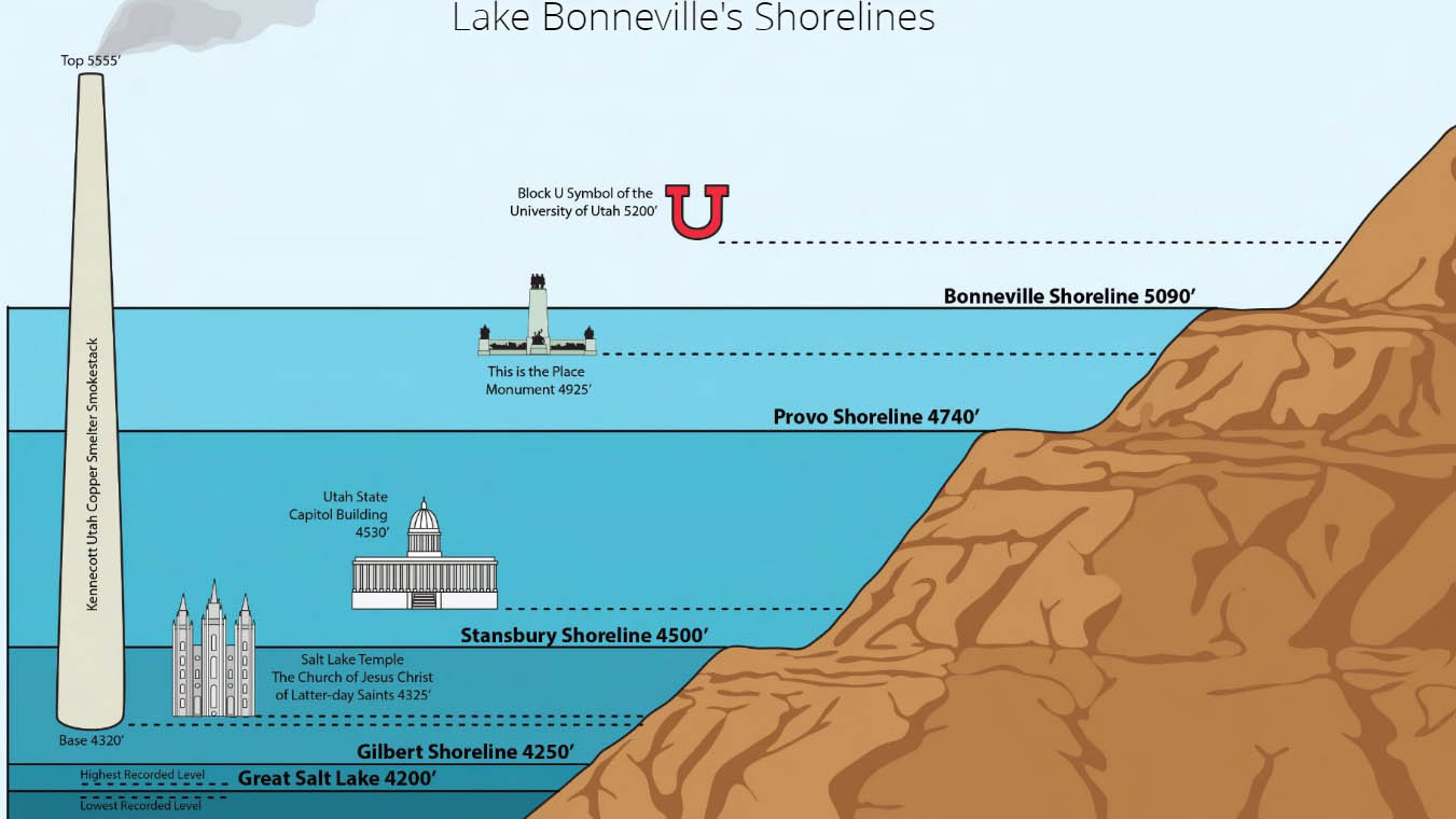 |
| Image from Utah DNR, link to storymap. |
Now you get to try to spot the shorelines:
 |
| Same view of the north side of the Oquirrh Mountains at the Kennecott Smelter, without labels. Photo was taken May 2022. |