Showing posts with label Great Salt Lake. Show all posts

16 December 2022

Photos of Black Rock by William Henry Jackson

While perusing the digital collections of the University of New Mexico, I came accross these new to me photos of Black Rock in the Great Salt Lake.  Black Rock is a geologic feature near the present-day Great Salt Lake Marina and State Park. 

These were taken by William Henry Jackson in about 1880.

Black Rock, Great Salt Lake, Utah. Image from UNM.

Black Rock, Great Salt Lake, Utah. Image from UNM

Black Rock, Great Salt Lake, Utah. Image from UNM

View of Great Salt Lake. Image from UNM.

07 September 2022

Vintage Postcards Showing Black Rock in the Great Salt Lake

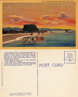
More vintage postcards about the Great Salt Lake, these are specifically about Black Rock.

The first postcard is from the 1910s-1920s and the others are 1940s.

The second postcard is actually at Sunset Beach, which is just a smidge east of Black Rock. Sunset Beach is between Black Rock and the Great Salt Lake Marina.

And, as an FYI, the Great Salt Lake Marina is at Silver Sands Beach.

I didn’t realize until recently that we had named beaches


Vintage Postcards About the Great Salt Lake

“Greetings from the Great Salt Lake” is the topic of today’s #WestDesertWednesday

I like looking at old postcards to see how the landscape and people have changed. When looking at postcards about the Great Salt Lake there seems to have been quite a bit of human interaction with it in the past- both locals and tourists. Obviously, Salt Air was a hot spot but so was Black Rock (which I will post those images right after this one).

Now Black Rock is a lonely rock and is high and dry. The marina is unusable and all the boats have been pulled out. Those wood trestles of the Lucin Cutoff have been pulled out (and repurposed by a local).

And even the new Great Salt Air seems a lonely shadow of its past.

My guess is that most of these postcards are from the 1970s-1980s. The postcard showing the reading of newspapers in the lake is probably from the 1940s. And the new Great Saltair postcard appears to be from 1990s.


Source of images: personal collection and Ebay. 

08 August 2022

Lake Bonneville Animation

I made a thing! Of course, it is of my favorite Pleistocene-age closed-basin lake system = Lake Bonneville!


Also, I had to make a YouTube channel, so I guess you can check that out too.

07 August 2022

Salt Lake County in Relation to Lake Bonneville

The Salt Lake Valley has Lake Bonneville shorelines on the west (Oquirrh) and east (Wasatch) sides of the valley. You just need to look at the mountainsides to see those etched horizontal lines (the Provo and the Bonneville being the easiest to spot).

But it is also fun to see where those shorelines are in areas where it is more difficult to spot them, like under the built environment of our cities.

This map shows how the cities of Salt Lake County are situated in relation to the shorelines.

More about Lake Bonneville!

Lake Bonneville was a Pleistocene-age lake (the last Ice Age). Similar to how the Great Salt Lake is today, the shorelines of ancient Lake Bonneville responded to changes in climate; the lake level increased when it was wetter/cooler and it lowered when it was warmer/drier.

Lake Bonneville was one of several closed-basin lake systems in the Great Basin during the last Ice Age; Lake Lahontan in Nevada being the largest but lots of little ones too. If you find yourself on a playa anywhere in the Great Basin, then you are at the bottom of an ancient lakebed.

The maps in my post show the geographic extent of Lake Bonneville overlayed on top of a modern map. I will detail the SLC area in my next post. The images are in order of highest elevation to lowest, but not in chronological order.

The Stansbury level is the oldest of the main shorelines. The final image shows the Great Salt Lake modern low (today).

Lake Bonneville was a cold freshwater lake. The highest mountain tops (Wasatch, Deep Creeks, etc) had large glaciers and the lake had its fair share of icebergs floating around, it was the Ice Age after all.

My interest in Lake Bonneville relates to the first people living in our area. It’s unclear exactly when people first inhabited the Bonneville Basin. Clearly, people did not live underwater but the shorelines certainly were utilized at some point.

Archaeological evidence shows that people were living and working along shorelines, at least around the Gilbert phase during the Pleistocene-Holocene transition.

A human-made fire hearth documented at the Wishbone archaeological site in the Great Salt Lake Desert shows people were in this area at least by 12,300 years ago. It seems that at least parts of the lake at this time supported freshwater fish and there is direct evidence of Mammoths and waterfowl present, making it an attractive place for ancient people.

Paul Inkenbrandt has put together a fantastic Story Map of Lake Bonneville that you should check out. https://storymaps.arcgis.com/stories/f5011189bdc94545b9231d56e4ffc1e4


19 July 2022

Identifying the Bonneville Shorelines

Those large terraces seen on the mountains throughout Utah are the shoreline remnants of Lake Bonneville which covered most of northern and western Utah during the Pleistocene (the last Ice Age). More about the geographic history of Lake Bonneville later.
A wide overview of the north side of the Oquirrh Mountains at the Kennecott Smelter. The 3 main shorelines are highlighted.

A more detailed view of the same location.

The first thing is to start spotting and identifying the primary 3 shorelines seen along the Wasatch Front and throughout Utah’s West Desert.

Those three shorelines are named (from highest to lowest):

Bonneville:
The Bonneville shoreline is usually the easiest to spot, it is the highest in elevation and thus marks the lake at its peak. The Natural History Museum of Utah sits along this shoreline as does the Salt Lake Flight Park (paragliders) in Draper. The Bonneville Shoreline Trail generally follows this shoreline.

Provo:
Provo is also a prominent shoreline, visible in most places where the Bonneville Shoreline can be seen. It often has draperies of tufa (a calcium carbonate precipitate, best known for the tufa “spires” in Mono Lake). The Provo shoreline was formed when the lake overflowed at Red Rock Pass in Idaho. The continued erosion of this natural dam caused the lake to recede quickly and drain to the ocean through the Snake River. The lake stabilized at the Provo shoreline level.

Stansbury:
This shoreline is more subtle than the Bonneville or Provo. The Stansbury shoreline is the oldest of the 3 main shorelines and has been eroded and reworked by the later Bonneville and Provo shorelines. As such, it is only visible in certain areas.

There is also the Gilbert Shoreline, but that is a whole different post. There are lots of active investigations and discussions about the Gilbert. And it is generally hard to spot so I have excluded it here.

I like this image from Utah's Department of Natural Resources G.K. Gilbert Geologic View Park that shows the lake levels of each shoreline in relation to landmarks of Salt Lake City.  
Image from Utah DNR, link to storymap.

Now you get to try to spot the shorelines:  
Same view of the north side of the Oquirrh Mountains at the Kennecott Smelter, without labels.
Photo was taken May 2022.

02 March 2022

Greetings from Salt Lake City 1939

Greetings from SLC, 1939!

Alice sent this postcard in 1939 on her way west to "Frisco." They would have likely driven US 40 and taken the Wendover Cutoff across the Great Salt Lake Desert. A lonely 2-lane road. Hope they made it safely to San Francisco.

Greetings from Salt Lake City postcard, dated 1939

I have rebooted my Twitter page @SLC_History. I think I will be posting little snippets of history there, probably lots of postcard images.

Don't like Twitter, no worries as I will post here as well. 

02 October 2021

500 Eels Are Creepy Creatures

American Eels. From Getty Images.

Welcome to October (and my first #SpookySLC post). And yes eels are creepy creatures and I would hate to stumble upon 500 eels.

In July 1872 Albert P. Rockwood imported 500 American Eels and released them into the Jordan River.

Rockwood was Superintendant of the Zion Cooperative Fish Farm and Utah’s first Territorial Fish Superintendent. He was tasked by Brigham Young to determine why Utah’s native trout population was declining and to increase fish populations in waters along the Wasatch Front.

In addition to trying to propagate local trout species, his approach was to import exotic fish species. In addition to the eels, he introduced King Salmon, American Shad, lobsters, oysters, Asian Carp, and numerous other species. Many of these species (especially lobsters and oysters) failed immediately but we are now living with many of the impacts of his efforts such as the abundance of carp just about everywhere.

In 1871 Rockwood built a fish farm in Sugar House- probably near what is now the Forest Dale Golf Course. On the 20-acre farm he build a hatching house and 12 fish ponds fed by a large spring with water at a constant temperature of 55 degrees.

Rockwood’s trial-and-error methods combined with regular reports of his efforts and correspondence with the Smithsonian Institute means that his enterprise was the first scientific fish hatchery in the world.

One of his first attempts at fish farming was to import 500 baby American Eels from the Connecticut River in Massachusetts. Once the eels were about 4 in long he released them into a nearby tributary of the Jordan River.

The eels were seen sporadically over the next few years. One was caught and released in Sept 1874 in Utah Lake near the mouth of the Provo River, it measured 2 feet long.

Another was found dead in Jan 1875 along the shore of the Great Salt Lake near Centerville and was eaten by its finders who said “it was cooked and found to be well pickled in salt.”

The last sighting of a living eel was in the Jordan River just south of SLC in 1875.

Rockwood died in 1879 but others continued his fish farming experiments, thankfully without the eels.

Sources:
Utah Stories Sugar House Prison Farm by Lynne Olson; SL Herald Republican 1871-07-30; Des News 1873-03-26; Utah County Times 1874-09-10; Des News 1875-08-25; Des News 1875-01-27; Des News 1876-02-03; SL Herald Republican 1879-11-27; The Phrenological Journal and Life Illustrated Jan 1874.

American Eel, image from USFWS.

26 November 2020

The Lucin Cut-off Officially Opened on Thanksgiving Day 1903

Midlake Station, Lucin Cut-off, Great Salt Lake vintage postcard

Built by the Southern Pacific Railroad between 1902-1903, the Lucin Cut-off spans the north arm of the Great Salt Lake and was one of the greatest engineering feats of its time.

On Thanksgiving Day, Nov 26 1903, Mr. E. H. Harriman (President of the Southern Pacific Railroad) led 3 special trains composed almost entirely of private cars filled with newspaper reporters and prominent railroad men from across the country.

On that day he formally inspected the cut-off and declared it open for business (although regular trains would not utilize it for several more months).

The special private trains departed Ogden in the morning and arrived at Midlake Station after a 2-hour trip, the trains at one time going as fast as 33 miles per hour.

Although much anticipation was made about the opening ceremonies, which was to including the driving of a golden spike, once Harriman and company arrived at Midlake Station only a group photograph was taken and the band played a couple of patriotic tunes but no speeches were made or other elaborate ceremonies.

The trains resumed their travel west to the Lakeside construction camp where they met with 800 railroad workers who were on their way to Thanksgiving supper. The special visitors and workers stood in a long line to the kitchen and each secured a mince pie, sandwich, and cheese. These prominent citizens and the workers then sat down upon benches, boxes, and barrels and enjoyed their food.

After the little feast at Lakeside, two of the trains continued west and a Thanksgiving dinner was served in the dining car while the party continued to Nevada.

The train containing the Utah group returned to Ogden where a Thanksgiving banquet was served by the Weber Club.

Sources: Ogden Standard, SL Herald, San Francisco Call, all from 1903-11-27

HAPPY THANKSGIVING! 🦃

Lucin Cut-off map, 1906. From UDSH.

Thanksgiving Day 1903, Lucin Cut-off. President Harriman
is at the far right with his hand on a post. From Standard Examiner

Lucin Cut-off, September 1903. From UDSH.

04 October 2020

Spooky SLC: John de Baptiste the Infamous SLC Cemetery Grave Robber

SLC Cemetery at night from 11th Ave

In the 1860s, John de Baptiste robbed hundreds of graves in the SLC Cemetery, Part 1.

In Jan 1862 Utah’s “three-week” Governor, John W. Dawson made a lewd proposition to a society lady in SLC which resulted in his being chased down and beaten by a relative of hers.

Warrants were issued for all members of the gang involved in the beating and Porter Rockwell tracked some of them down, killing the gang leader, Lot Huntinton. Moroni Clawson and John Smith were taken into custody but were killed the following morning, allegedly during an attempt to flee police custody.

The bodies of Huntinton, Clawson, and Smith, were all buried in the Salt Lake City Cemetery.

Initially, the body of Moroni Clawson went unclaimed and in a charitable gesture SLC police officer, Henry Heath, purchased burial clothing for Clawson.

About a week later Clawson’s brother, George, came to town to exhume the body and rebury him in the family plot in Draper. Upon opening his brother’s coffin he found the body naked.

Clawson and Heath asked the cemetery Sexton about the situation and he suggested talking with the cemetery grave digger, John de Baptiste.

While at Baptiste’s home on 3rd Ave the two noticed boxes containing “sickening heap of flesh soiled linen” and funeral robes of people who had been buried in the City Cemetery for the past several years. Infant clothes and about 60 pairs of children’s shoes were found along with adult funeral robes and men’s shirts, caps, and socks.

Officer Heath was particularly outraged and was concerned about the grave of his daughter being desecrated. Heath immediately confronted Baptiste at the City Cemetery and “choked the wretch into a confession” of robbing graves, dumping the bodies out of their coffins, and using the wood for kindling in his home.

Baptiste confessed to robbing only a dozen graves but the evidence pointed to at least 300 grave robberies over a 3 year period, mostly those of women and children.

After the confession of grave robber John de Baptiste, a 50 ft long table in the courthouse was covered with several hundred funeral suits, shoes, and clothing recovered from Baptiste’s house.

Relatives of the deceased came to identify and claim the clothing. Many of the family members were intent on reclothing their deceased relatives out of fear that without proper burial clothing the religious ceremonies and rites would be incomplete.

Brigham Young addressed the people and told them not to disinter their relatives but to let them be in peace and he promised them that they would “be well clothed in the resurrection.” Ultimately, all agreed that the clothing would be reburied into a single grave site at the SLC Cemetery.

Brigham Young told the people that killing Baptiste was too good for Baptiste and that he wished to banish him and “make him a fugitive and a vagabond upon the earth.” So, Baptiste was sent to Antelope Island where he was tattooed with the words “Grave Robber” on his forehead.

On Antelope Island he was met by Henry and Dan Miller. The Miller brothers kept cattle on Fremont Island and they agreed to transport John Baptiste by boat to Fremont Island and allow him to remain there alone with their cattle. They provided him with a shack and provisions every few weeks.

After 3 weeks on Fremont Island, the Miller brothers checked in on Baptiste and he seemed to be getting along quite well and helping himself to the provisions left for him in the shack. But 3 weeks later Baptiste was gone. The Miller brothers found that part of the shack had been removed and one of their cows had been slaughtered and the hide cut into strips. Baptiste had made a raft of the wood from the shack and the hide of the cow.

It is unknown what happened to Baptiste. Some stories indicate that he escaped by raft to Promontory Point where he caught the railroad. Some say he did not even make it out of the Great Salt Lake and must have drowned.

Source: The Saint and the Grave Robber by John Devitry-Smith

An open grave at SLC Cemetery.
Imagine this one filled with previously used burial clothing!