Showing posts with label Historic Trails. Show all posts

03 July 2026

Panchucunquibiran with Domínguez and Escalante

In 1776, while thirteen colonies on the Atlantic coast declared independence, two Spanish friars were in the West. Domínguez and Escalante's search for a route from Santa Fe to California eventually took them through Colorado, Utah, and Arizona.

The expedition's path through Utah was based entirely on the knowledge of their Indigenous guides.

While in Utah in September 1776, they crossed the Green River and journeyed to areas near Strawberry Reservoir, Spanish Fork Canyon, Utah Valley, Sevier River, Milford, Cedar Valley, and the Virgin River.

Of course, Domínguez and Escalante named and renamed things along the way. Their name for Utah Lake was Laguna de Nuestra Señora de la Merced de los Timpanogotzis, translated to "Lake of Our Lady of Mercy of the Timpanogotzis."

The name is in honor of both their Catholic faith and the name of the people living around Utah Lake identified by one of their Indigenous guides, Panchucunquibiran, as the Timpanogotzis people.

Panchucunquibiran was himself Timpanogotzi (called "Laguna" by Escalante, the Spanish term for the same lake-dwelling people) and was one of two second-tier chiefs beneath the head chief, Turunianchi, as explained to the friars through a painted hide depicting the tribe's leadership hierarchy.

The name “Timpanogos” is still with us today.
 
Clip from the C. E. Erickson, The Escalante Trail: 1776

Clip from Bernardo de Miera y Pacheco's Map 1778


SOURCES:

C. E. Erickson, The Escalante Trail: 1776, [G4300_1776.B6.jpg]. Arizona Memory Project, accessed March 7, 2026, https://azmemory.azlibrary.gov/nodes/view/257568

Joel C. Janetski, The Ute of Utah Lake, Anthropological Papers no. 116 (Salt Lake City: University of Utah Press, 1991).

Bernardo de Miera y Pacheco, cartographer, Plano geográfico de los descubrimientos hechos por Dn. Bernardo de Miera y Pacheco y los RRs. Ps. Fr. Francisco Atanasio Domínguez y Fr. Silvestre Vélez: S. Felipe Rt. de Chiguagua [cartographic material], 1778. Yale University Library, Beinecke Rare Book and Manuscript Library, WA MSS S-2856, https://collections.library.yale.edu/catalog/2002707

David E. Miller, ed., The Route of the Domínguez-Escalante Expedition, 1776–77: A Report of Trail Research Conducted Under the Auspices of the Domínguez-Escalante State/Federal Bicentennial Committee and the Four Corners Regional Commission (Domínguez-Escalante State/Federal Bicentennial Committee, 1976), https://collections.lib.utah.edu/ark:/87278/s6qmeb5m

Robert S. Russon, “A Trail Guide to the Domínguez-Vélez de Escalante Expedition 1776” (M.S. thesis, Department of History, Utah State University, May 1973), USU Digital Commons, https://digitalcommons.usu.edu/cgi/viewcontent.cgi?article=9154&context=etd

Nick Saenz, “The Domínguez-Escalante Expedition in Ute Country,” History Colorado, August 6, 2025, https://www.historycolorado.org/story/2025/08/06/dominguez-escalante-expedition-ute-country

Claudio Saunt, West of the Revolution: An Indian Continent Shaken by Distant Empires (W. W. Norton, 2014).

17 October 2022

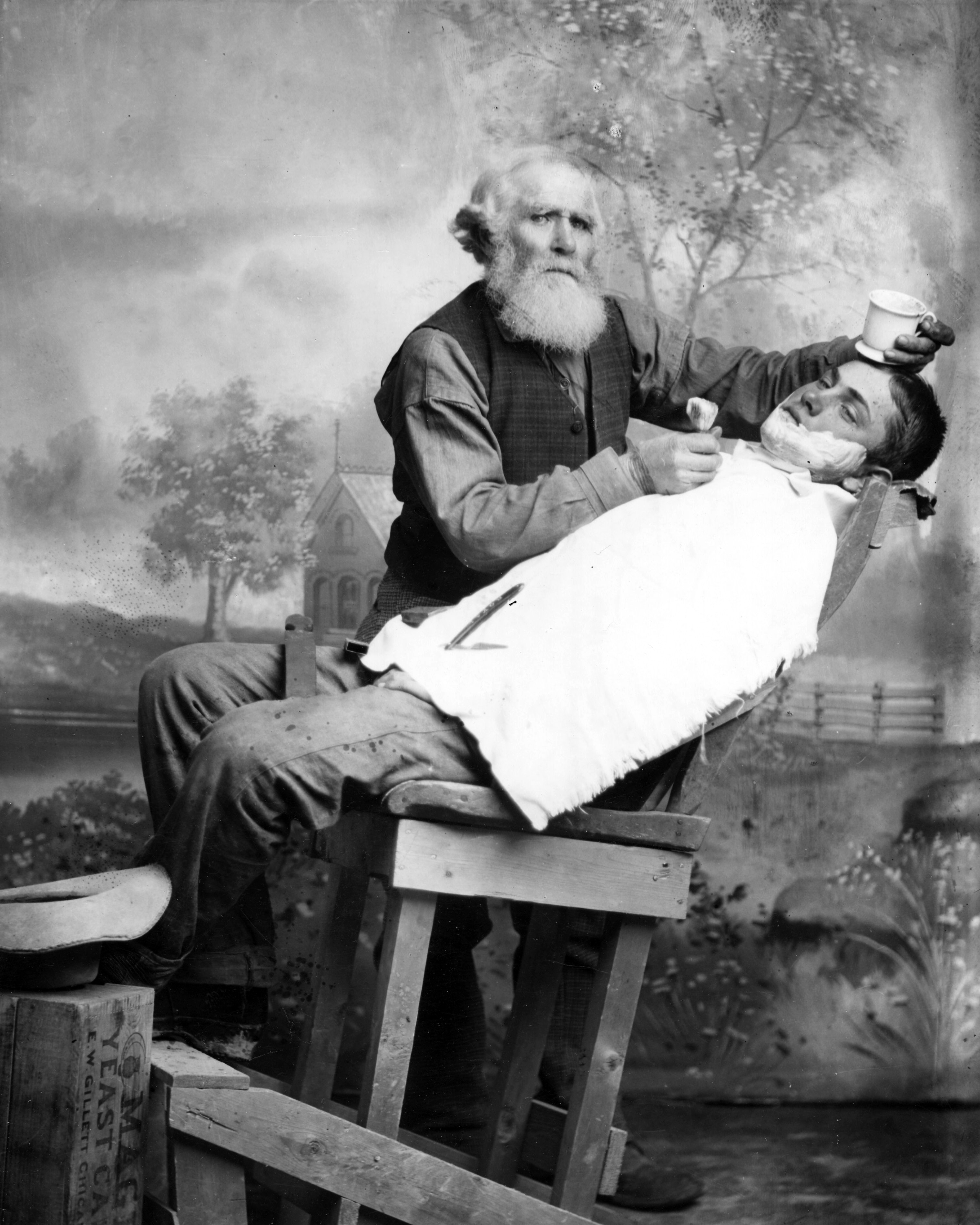
The story behind the "creepy barber" photograph

 The “creepy barber” photo from my last post stuck with me so I tracked down its story as part of October's Spooky Salt Lake City month. The photo is from the digital archives of the Utah State Historical Society, a direct link to it is here. 

 James Walker, barber and Parley Fullmer.  Mount Pleasant, Utah, 1892. George Edward Anderson Photograph. Image from USHS.

The barber is named James Walker (1831-1899) and when this photo was taken in 1892, he was living in Mount Pleasant, Utah. This image is an advertising photo that was taken in the studio of noted Utah photographer George Edward Anderson (1860-1928) (probably his Manti location).

James Walker was born in England and arrived in SLC in 1855, traveling in a Mormon emigrant wagon train from Kansas across the plains. He lived in SLC for a couple of years and in 1857, after his marriage to his wife Margaret, he traveled to Central Utah (Manti, Mount Pleasant) where he and his wife raised their 12 children.

Of note, his father crossed the plains in a handcart company a year later, in 1856, and was killed by a lightning strike in Nebraska.

James has similar creepy eyes in other photographs of himself, so it seems this is his normal appearance.

James Walker.  Image from FamilySearch courtesy Gerald Shupe.

Margaret and James Walker. Image from FamilySearch courtesy Nathan Coffey.

The other individual with the barber is Parley P. Fullmer (1876-1931) who would have been about 15 when this photograph was taken.

Parley also worked several different jobs in his life but his last one was as a miner for the Utah Galena Corporation mine in the Tintic Mining District (in Utah’s West Desert).

Parley P. Fullmer. Image from Ancestry courtesy Andrew White.

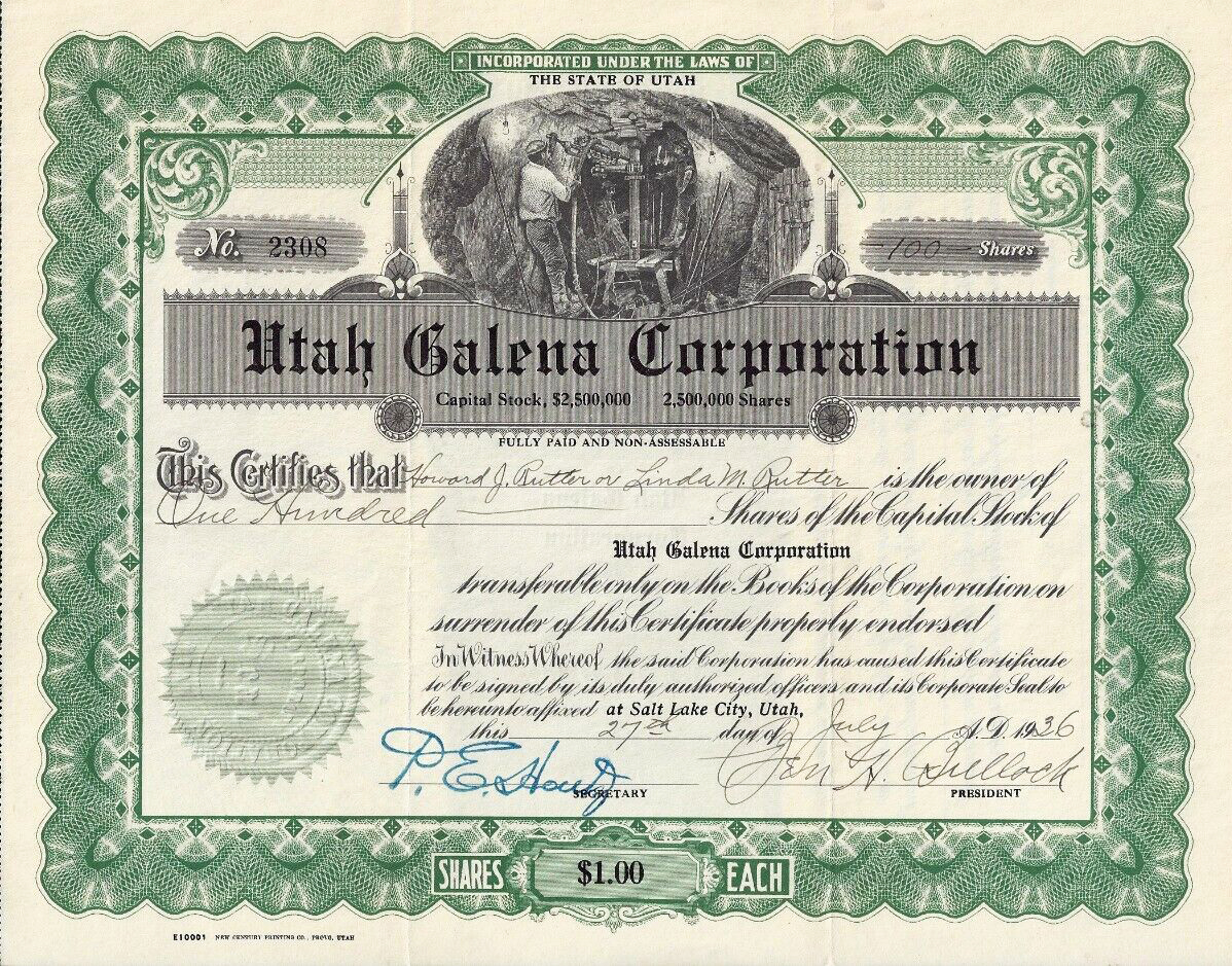
Utah Galena Corporation stock certificate, 1936. Image from eBay.

Parley’s death in 1931 was terribly gruesome and tragic. After the day’s work, Parley and another worker were being hoisted out of the mine, which was described as 755 feet deep.

After being hoisted about 30 feet, the clutch of the elevator engine became disengaged, but the engineer was able to prevent the elevator from falling by holding the brakes while he reengaged the clutch.

Unfortunately, Parley was scared and nervous and started climbing on top of the elevator’s overhead crosshead. When the elevator began moving upward again, Parley became trapped between the elevator and the walls of the shaft. His head was crushed, and his body mangled.

Detail of the mining scene from the Utah Galena Corporation stock certificate, 1936. Image from eBay.


Sources:
Church History Biographical Database
FamilySearch
Eureka Reporter April 9, 1931
Eureka Reporter July 23, 1931
Western Mineral Survey April 12, 1929

02 October 2022

Salt Lake House Pony Express Station

Speaking of the Pony Express and Overland Stage, Salt Lake City was home to one of the main stations where travelers could rest, mail was distributed, and news from the rest of the nation was received.

Detail of the Pony Express Marker, Main St Salt Lake City, April 2022

Pony Express Marker, Main St Salt Lake City, April 2022

Pony Express Marker, Main St Salt Lake City, April 2022

The Pony Express utilized the existing hotel Salt Lake House as its home station in SLC. This was a “mixed-use property” (hahaha) composed of a two-story building and had a restaurant, hotel rooms, ticket office, administrative offices, various businesses (dry goods, barber, cigars), and room for boarding of horses and livestock in the back.

The Salt Lake House was located on the east side of Main Street between 100 and 200 South (Block 70) and it is now marked by Pony Express Monument that was placed in 1931, the first marker erected along the Utah Pony Express stations. The Pony Express barns were located across the street in the central part of Block 69 and accessed by an alley at about 130 S Main St.
 
Main Street of Salt Lake City, mid 1860s. Image from UDSH, modified by the author.

Composite image. Top: illustration of Salt Lake Hotel with Wasatch Mountains in the distance, Image from UDSH. Bottom: Salt Lake House with stagecoach at 167 S Main, from UDSH.

The address of the old Salt Lake House varies depending on the source and the 1931 marker has been moved south of its original placement. So, I’m not completely sure of the address of the old Salt Lake House but I’m going to go with the Sons of the Utah Pioneers Aug 2022 article that indicates it is where the Neumont College - College of Computer Science building is now located at 143 S Main St SLC. Of note, plaques were reinstalled in Jan 2022 on the south side of this building.

The first arrival of the Pony Express in SLC was Wed April 11 1860 and was described by the Deseret News as a day of heavy rain.
 
The first arrival of the Pony Express in SLC. Deseret News April 11 1860.

The Salt Lake House was where Mormons and non-Mormons alike would congregate, eat, talk, and buy hard-to-get items like jewelry imported from outside of Utah. Mark Twain/Samuel Clemens stayed here during the 1870 overland journey that he wrote about (and embellished) for his book, Roughing It.

Composite image. Advertisements from Deseret News Feb 16 1859 and May 8 1861.

Although the Pony Express did not last long, the Salt Lake House endured through the Overland Stage days. In 1930 an old-timer recalled “how we would stand around the old Salt Lake House waiting for the stage, with its six horses, to come tearing down the street, and how the driver, with his long whip, would swing it around his head as he yelled, “Whoa!” It was a pretty sight to see the stage come in loaded to the guards with mail express and passengers.”

The Salt Lake House was demolished in 1887 by the Auerbach brothers.
 
Diamond Jubilee Pony Express celebration, Salt Lake Tribune Aug 11 1935

Sources:
Salt Lake Evening Democrat May 6 1887;
Salt Lake Telegram July 20 1930;
Salt Lake Tribune March 31 1935;
Sons of the Utah Pioneers Trail Marker Aug 2022

28 September 2022

These trail markers tell the story of historic migrations and explorations in their own words

Trail marker at the summit of Dugway Pass, Dugway Mountain Range, Utah

In my last #WestDesertWednesday post I talked about the U.S. Army’s Capt. James H. Simpson’s 1859 expedition to map an overland route heading west from Salt Lake City and Camp Floyd, a decade before the joining of the railroads at Promontory Point in 1869.

This route was utilized by the Pony Express (mail stations began to be established in 1858 and were in operation 1860-1861), Overland Stagecoach (1860s-1890s or so), Lincoln Highway (1913+), and in some places U.S. Route 40 (1926+). It was a successful route because it avoided the mucky Great Salt Lake Desert (ahem… Donner Party) and utilized the many natural springs in the area.

Eventually, this route was abandoned in favor of what is now Interstate 80 across the Salt Flats…. The creation of that cut-off route is a complicated story in and of itself.

Nowadays, you can drive much of Simpson’s original route through Utah’s West Desert, and I plan on showcasing several interesting stops along the way.

These historic trail markers are found along the various historic trails. They provide a brief excerpt from written reports of the original explorations. These markers are established and managed by the Utah Chapter of the Oregon-California Trails Association (OCTA). https://www.utahcrossroadsocta.org

Here are a few that I saw along a recent weekend trip through Utah’s West Desert.


The 2 maps shown here are taken from BLM publications on the Pony Express in Utah.