May 2, 1859, Capt. James H. Simpson departed from Camp Floyd (now a Utah State Park Museum in Fairfield, UT) and headed west “to explore the country between [Camp Floyd] and Carson River, at the east foot of the Sierra Nevada, for a new and direct route to California.”
 |
| Illustration from Simpson’s expedition, "Crossing the Great Salt Lake Desert from Simpson's Spring to Short Cut Pass, Granite Mountain in the Distance." Image from the National Archives. |
This new overland trail would eventually become the general route of the Pony Express, Overland Mail and Stage, Pacific Telegraph line, the transcontinental Lincoln Highway, and Highway 50.
 |
Photograph of a stagecoach that was used on the overland trail.
Image from Special Collections, J. Willard Marriott Library, link here. |
Simpson was an Army Topographical Engineer, an elite group hand-picked from West Point. (The Topographical Engineer Corps merged with the Army Corps of Engineers in 1863, which the organization is known by today).
The 64 members of his expedition included an artist, geologist, wheelwright, blacksmith, teamsters, surveyors, 20 soldiers, 12 six-mule wagons, and scientific apparatus.
After Jesse G. Petersen retired in 1999 as Police Chief of Tooele, he set about exploring the various trails of the Great Basin. In 2003 he authored the Utah volume of The Lincoln Highway book series and in 2008 he authored A Route for the Overland Stage. The goal of both books was to identify the exact locations of the trails, not just the general location which is commonly identified.
In recent years, Utah State University Press has made his Overland Trail book available for FREE as a downloadable PDF. The book intermixes Simpson’s recordings along with Jesse Petersen’s field observations.
 |
Cover of "A Route for the Overland Stage" by Jesse Petersen
|
 |
Excerpt from "A Route for the Overland Stage" by Jesse Petersen
|
 |
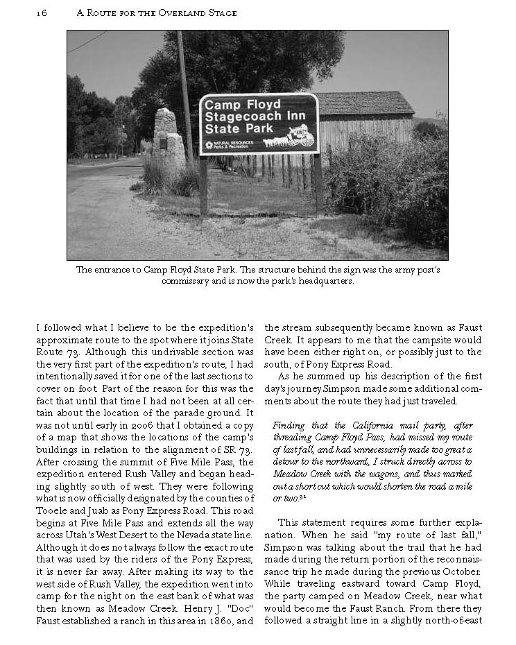
Excerpt about Camp Floyd, from "A Route for the Overland Stage" by Jesse Petersen
|
 |
Excerpt from "A Route for the Overland Stage" by Jesse Petersen.
(I added the green note).
|
One note of caution about the book, the coordinates published are in NAD27 and most GPS’s today default to WGS-84 or NAD83.
The link to the USU download site is here:
https://digitalcommons.usu.edu/usupress_pubs/114/Citation for the book:
Petersen, Jesse G., "A Route for the Overland Stage" (2008). All USU Press Publications. 114.
https://digitalcommons.usu.edu/usupress_pubs/114
 |
| Illustration of Bridal Veil Falls from Simpson’s expedition, titled "Beautiful Cascade, Timpanogos River Canyon." Image from the Utah Division of State History [color corrected by author] |


No comments:
Post a Comment